How to check if a site is in a disadvantaged community
Shade federally designated disadvantaged census tracts on the Evaluate map and read why a tract qualifies.
By the end you will know whether a site falls in a census tract that federal programs treat as disadvantaged, which can unlock extra funding. Start with the address open on the Evaluate map, as in How to look up an address on the Evaluate map.
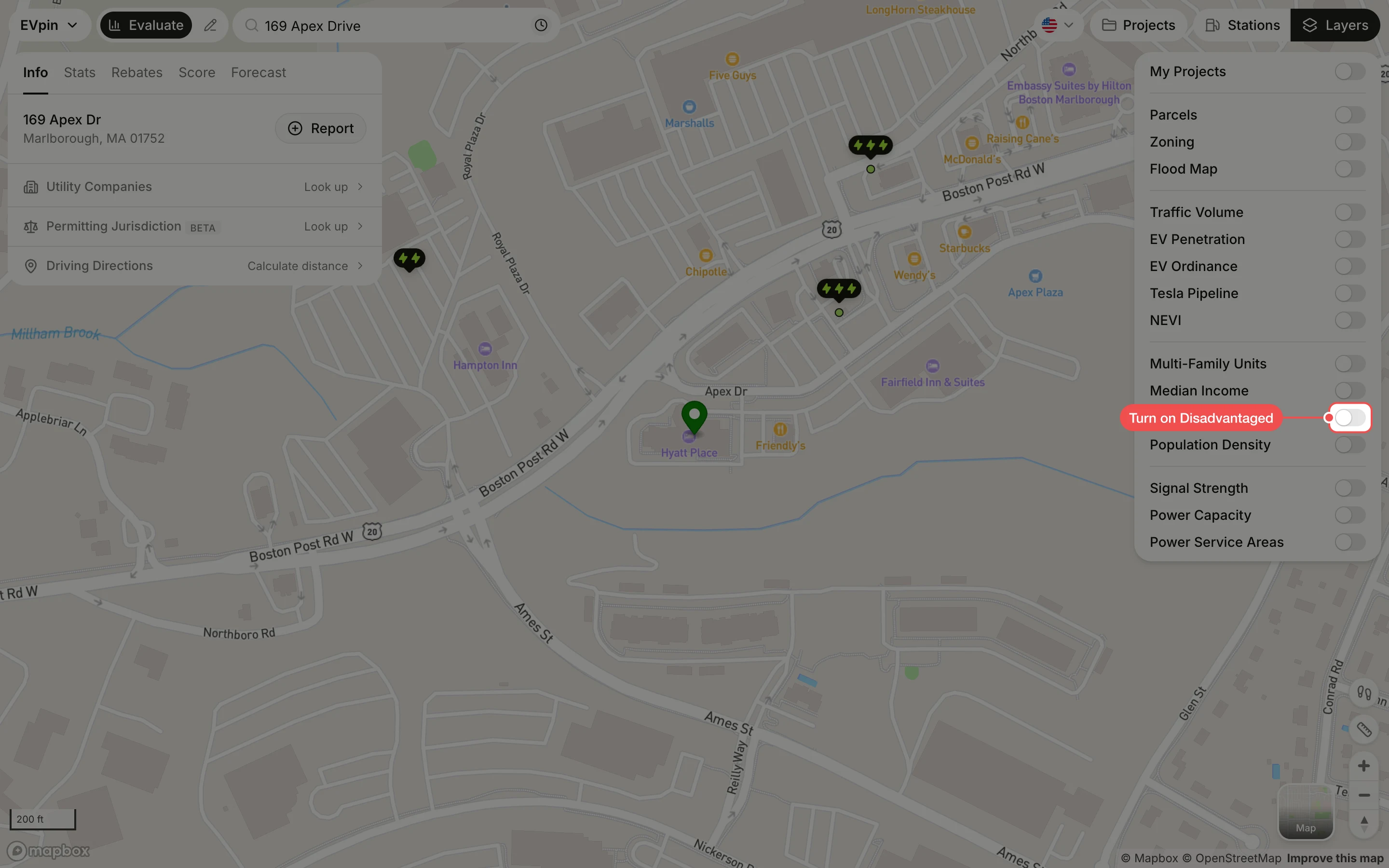
Turn on Disadvantaged
In the Layers panel at the top right, turn on Disadvantaged. Disadvantaged census tracts are shaded; if the site's area is not shaded, it is not in one.
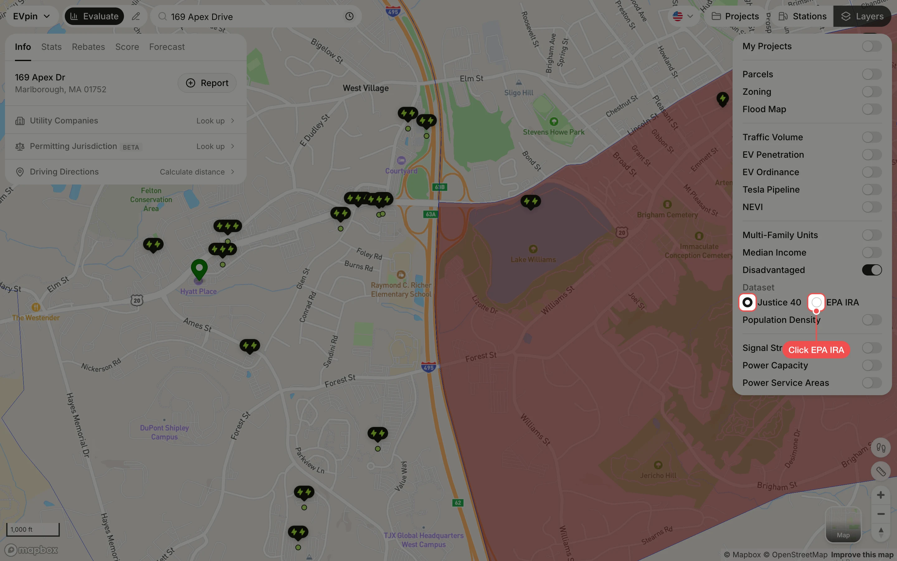
Click a dataset
Under Dataset, Justice 40 (the CEJST tool) is selected. Click EPA IRA to see the tracts the EPA designates for Inflation Reduction Act programs instead; check the one your funding program uses.
Click a shaded tract
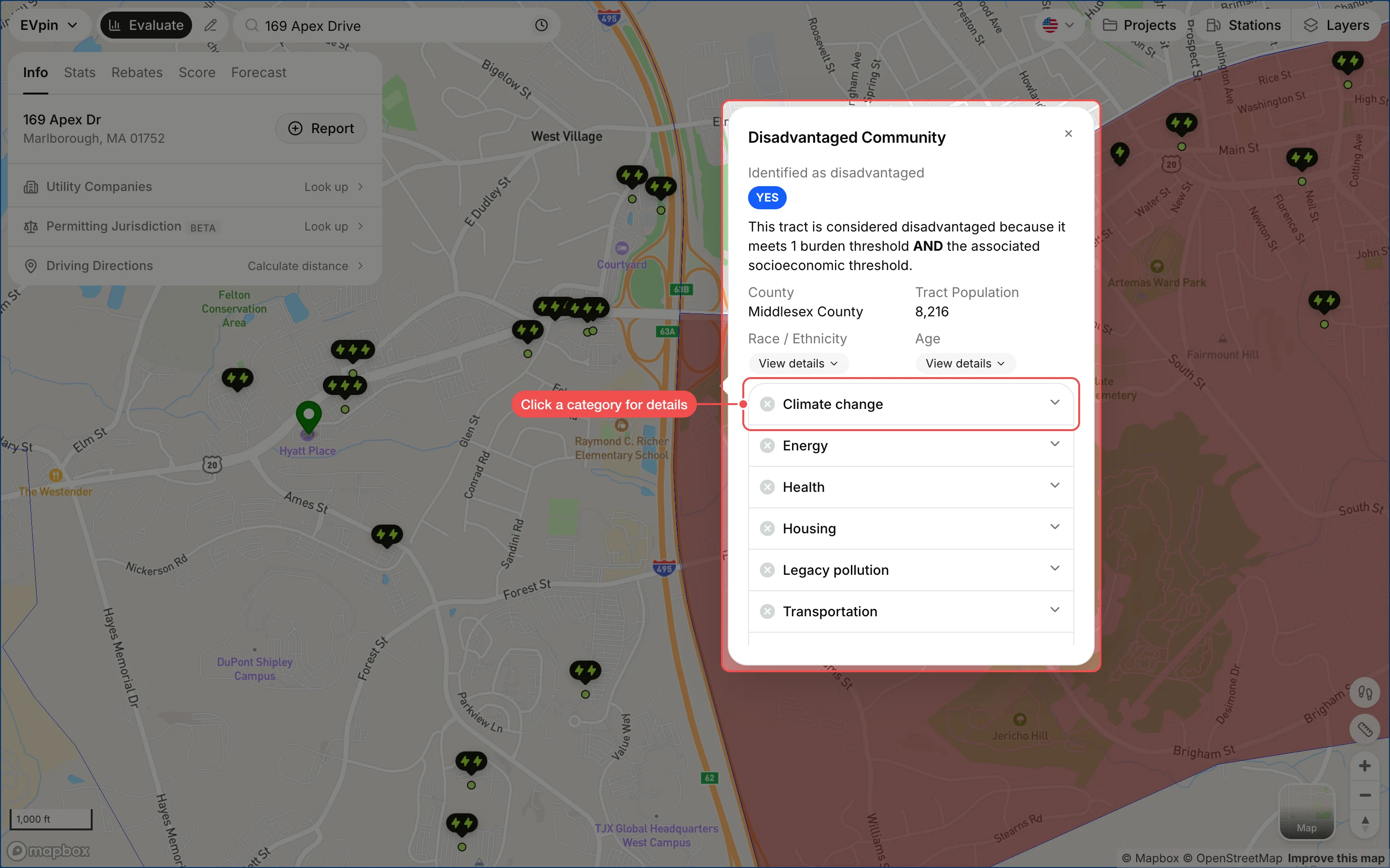
Click inside a shaded tract. The popup says whether it is identified as disadvantaged and why, with its county, population and the burden categories it meets. Click a category, such as Climate change, to see its indicators.